
Precision, Innovation & Excellence in Geospatial Solutions
Empowering Land Administration, Infrastructure Development, and Sustainable Resource Management in Uganda
Land Administration
Streamlining land processes for efficient management.
Innovative solutions for sustainable resource management.
Expertise in real estate and physical planning.
Dispute Resolution
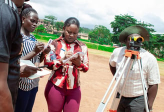
Capacity Building
About Fawa Geospatial Consultants
We specialize in surveying and geospatial services, focusing on land administration, infrastructure, and natural resource management in Uganda.


Our Expertise in Geospatial
Utilizing cutting-edge technologies, we ensure precision and efficiency in providing real estate services, dispute resolution, physical planning, and capacity building.
Our Services
Expert surveying and geospatial solutions for land, infrastructure, and resource management in Uganda.


Land Administration
Comprehensive land administration services ensuring efficient management and compliance with local regulations and standards.
Infrastructure Development
Innovative geospatial technologies to support infrastructure projects from planning through execution and monitoring.
Geospatial Excellence
Showcasing our expertise in land administration and resource management.


Fawa Geospatial Consultants transformed our land management process with their expertise. Their precision and cutting-edge technology made a significant difference in our project outcomes.
Esonyu Simon Peter

★★★★★
Services
Expertise in geospatial and land administration solutions.
Consultants
Precision
+256-764 644 661
© 2025. All rights reserved.
+256-743 480 428